")
Nepal expedition report. 2017, autumn, part 2
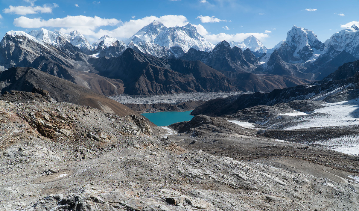
Khumbu
Days 21-26
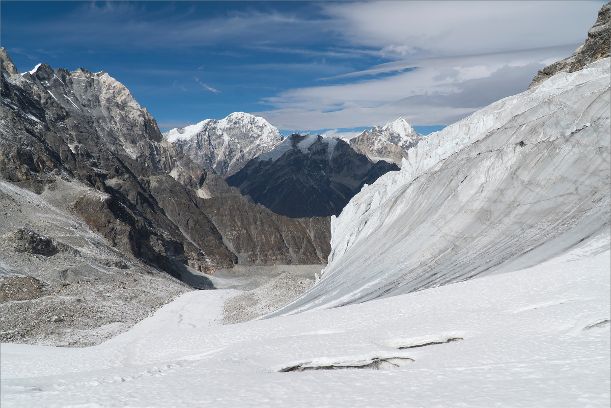
Chhukhung (4730m) - Dzongla (4843m) - Cho La (5420m) - Gokyo (4790m) - Renjo Pass (5360m) - Namche (3440m) - Thyangbo (4230m) - Tashi Labsta (5755m) - Glacier Camp (4650m) /111(472) km, 6 days, 1 rest day/
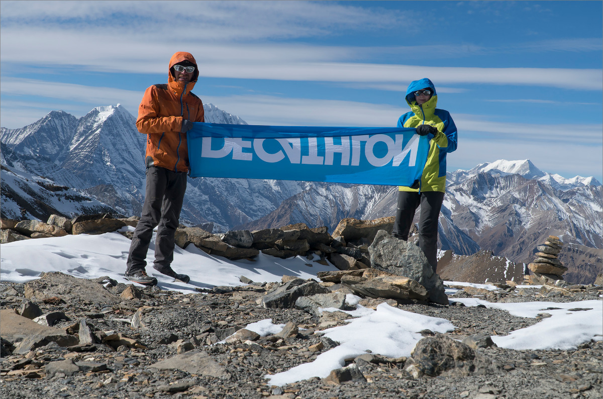
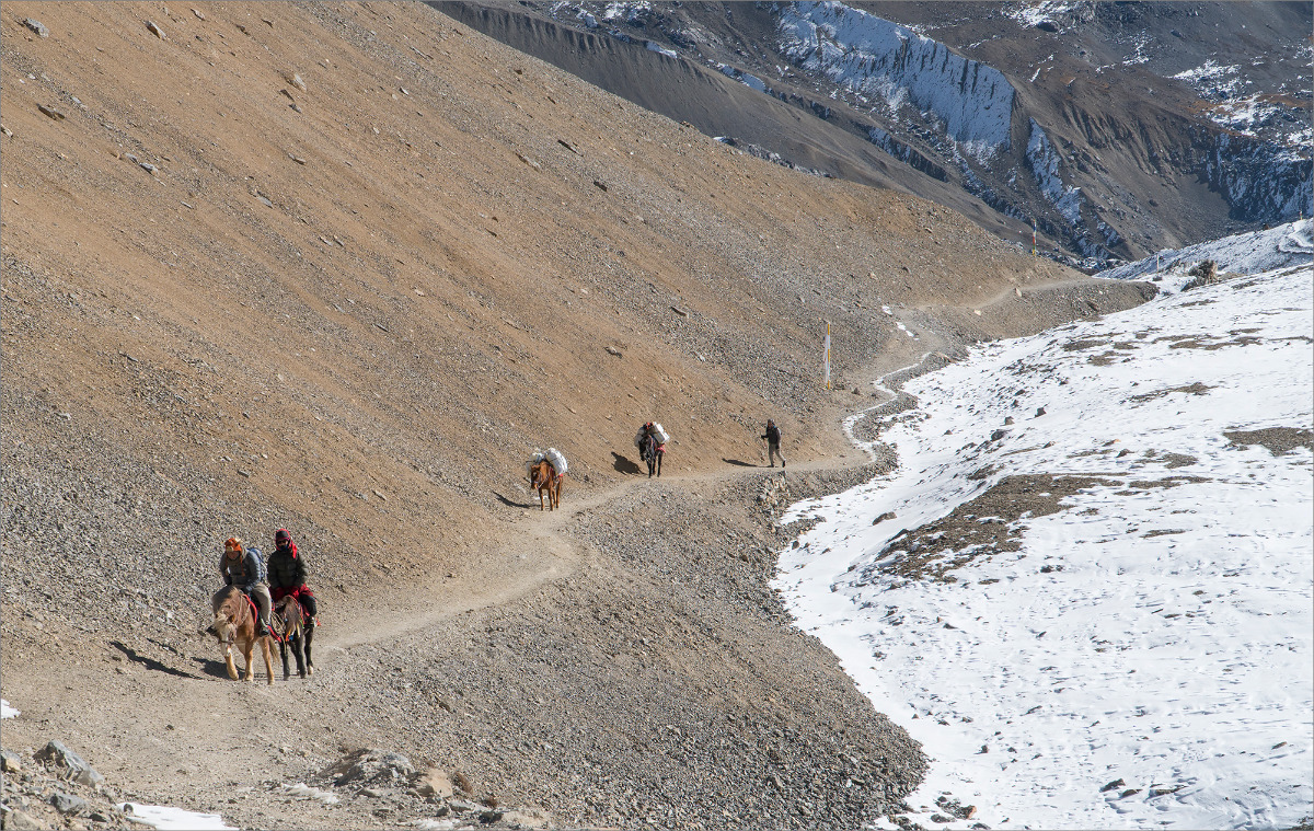
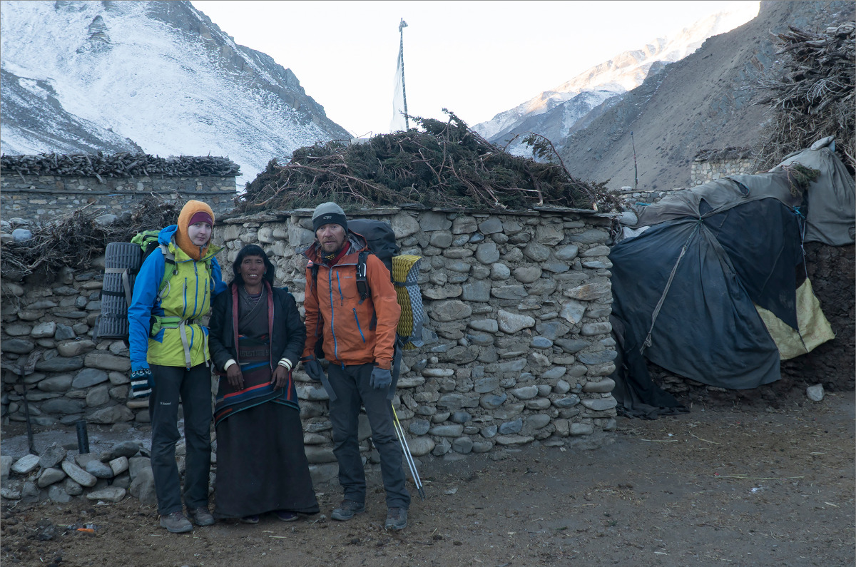
The Khumbu region is well known to us. We need to cross 2 passes: Cho La and Renjo Pass, both at 5300-5400 meters, and then head to Namche Bazaar, take a rest day, and cross over to Rolwaling via Tashi Labsta La. It takes a whole day to go straight from Chhukhung to Namche Bazaar, so we sent a porter with our gear to Namche Bazaar and hiked the passes without our equipment. There are a lot of people, and food is expensive, but the views are beautiful.
| Distance: | kilometer |
| Elevation (loss): | meter |
| Elevation (gain): | meter |
We met some guys from Moscow on the way. They wanted to give us some food, but we don't eat meat. Anyway, thank you!)
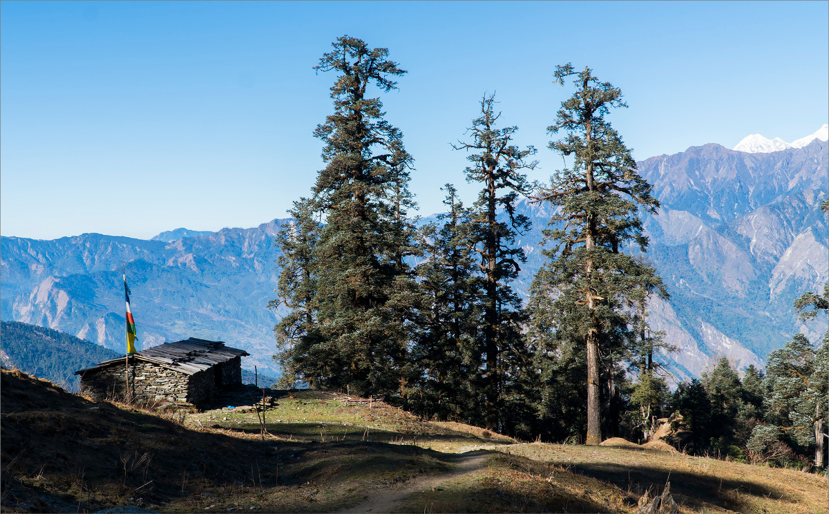
After resting and stocking up, we headed towards Tashi Labsta. Passing Thame, we went to the village of Thyangbo with only two houses. Our plan was to immediately head to "Na" from the village. "Na" is also a village, but it's beyond the pass. According to my rough calculations, it's 25 km away. We should be able to make it. The lodge owner even said that we were strong enough to do it.
Long story short, we didn't make it. The food there was just amazing, and we had to stay longer than planned. Plus, we got lost in one place. Luckily, we had enough food for an extra day. We camped on a glacier near Tashi Tso lake.
Rolwaling
Days 27-31
Glacier Camp (4650m) - Jagat (1150m) - Bigu Gompa (2516m) - Tinsang La (3778m) - Chaku (1170m) /140(611) km, 5 days/
In the morning, we walked to Na at a not very brisk pace, taking about 4 hours. We thought again that we definitely wouldn't have made it yesterday. Searching for a way among the stone rubble of the glacier at night is quite a challenge. Zero orientation. The flashlight, of course, helps, but not much.
Rolwaling is actually lowlands, meaning jungles, fields, villages... Resting place, in short. We realized that we would rest another time when we tried to get back to the trail from the village of Jagat after spending the night there. It was about a kilometer and a half climb. So what if these are low altitudes? Nobody canceled backpacks and heat. Anyway, we walk and sweat. Monkeys are making noise in the forest. Anya doesn't like them. We crawled to some forgotten village by the end of the day. We sheltered with the locals. They feed us well!
According to the plan, we headed to Bigu Gompa the next day, which is a monastery. When we arrived there, we found out that it was almost completely destroyed by the earthquake of 2015. They are, of course, rebuilding it, but the monastery is not the same anymore. However, they still fed us deliciously and generously.
We conquered the forest pass and spent the whole day walking along deserted ridges. In the summer, cattle are grazed here, but now it's empty. By evening, our knee joints were sore, and we descended to Chaku, also known as The Last Resort. There's a bridge and bungee jumping here. The hotel was pretty expensive, and the cheap shacks didn't look appealing either. We didn't have much money left before our resupply, so the choice was obvious. But we couldn't resist having coffee at the resort.
Langtang
Days 32-37
Chaku (1170m) - Tilman Pass (5308m) - Syabrubesi (1503m) /137(748) km, 6 days, 1 rest day/
We crawl up again from the very bottom of the gorge, step by step. First, an Indus temple, then a dusty road and buses coming towards us. But we have a plan: we won't climb up that unclear 3900-meter hill (although we spent the night at 1100 meters), but we'll bypass it from the side. There seems to be a trail according to the map. We arrived at Chhagam. And here, there are only monks and a monastery. Everything, of course, was in ruins after the earthquake, but they built something in a hurry so that there was a place to pray. But we have no one to ask for directions from... Only monks. Damn)
Long story short, we decided to hire a guide. We had no idea where we were going. We made the decision to hire a guide, but no one wanted to come with us. Eventually, we found two girls who were going to visit their grandmother and they showed us the way. And of course, they made some money off of the tourists as well.
Grandmother lives in a village where there are also only ruins, and small sheds are attached nearby. We were also sheltered and fed here.
I didn't plan everything well again, so we spent the whole day walking and didn't reach our planned overnight stop. Therefore, we spent the night in some kind of summer cabin. Luckily, there was snow around, so we scooped it up with a spoon.
On the next day, the snow became more and more. After passing Panch Pokhari, there was too much of it. We walked all day at an altitude of about 4,000 meters, but with a gain of more than 2 kilometers. Up and down, up and down. We finally reached Tin Pokhari, but there were no ponds there, everything was covered in snow.
In the morning, we planned to cross Tilman Pass and then descend to the inhabited area without any supplies. But again, I messed up with my planning. The pass was okay, not difficult, but there were flying rocks in some places. We needed to start early as the glacier was melting and spitting rocks. Anya got hit in the thigh but was left with just a bruise.
The descent was a another circus. At first everything was fine - snow, crevasses, ropes. Then there was a snow avalanche and steep conglomerates. And there was no way to avoid them. There was some kind of trail and tracks. It's evident that someone recently (hard to say when) had walked there. We move slowly, looking at the tracks and the trail. The moment of reaching a "flat" place was particularly pleasing. We literally ran in short sprints from the rocks falling from above.
And just when it seemed like everything was okay and we were saved, there was a surprise waiting for us. The trail was there, then it wasn't, and bushes, bushes, bushes... And at the end, there was no bridge. It was 5 pm, it was cold, and Anya was already feeling a little down. And then we came to a ford. I thought it was going to be a problem, but no - we silently undressed, crossed (it was so damn cold), got dressed again, and continued down.
It's at least a 3-hour walk to the nearest people. After about 40 minutes, darkness caught up with us and we began to tire out. Eventually, we stopped. Hot water with Theraflu kept our spirits up. It was sweet, sour, and not something you can drink a lot of.
In the morning, feeling a bit dazed (either from hunger or from the teraflyu), we set off towards Kyangjin Gompa. We walked for a long time. Then we had a long and expensive breakfast! The most expensive breakfast of the trip - 40 bucks.
We seemed to have regained our strength and started to descend. We walked for a long time, but finally arrived at the outpost in Syabrubesi. Internet, shower, food. Rest day come on!
Ganesh Himal
Days 38-40
Syabrubesi (1503m) - Pansan Pass (3830m) - Mangro Bhanjyang (2936m) - Myangal Bhanjyang (2975m) - Khorlabesi (860m) /99(846) km, 3 days/
We sent all our gear to Kathmandu, got our money and permit for Manaslu. Now we can hike light towards Annapurna, where our next resupply is expected.
Here it's also mid-mountain. There are also jungles, monkeys, cows, and goats. The passes are low. There are roads everywhere. And roads mean dust and mud. And sand in your teeth. We started to get a bit tired of this. We passed the first pass, Khurpudada La (3710m), avoiding the road, or rather taking shortcuts. Then we had to jump onto the road and walk on it almost all the way to the next pass, Pansan La. From the pass, we could see Manaslu, Anapurna, and Dhaulagiri.
We then descended along the trails to the river. It was long and hot. After two more forest passes, we could finally head down to the Manaslu region. By that time, we had gotten used to waking up in the dark, setting out at dawn, and finding a place to spend the night also in the dark. There was nowhere to go, the day was short, and time was catastrophically short. And so it was here too – we didn't make it to Tatopani – it was already too late – so we decided to stop in Kharlobesi.
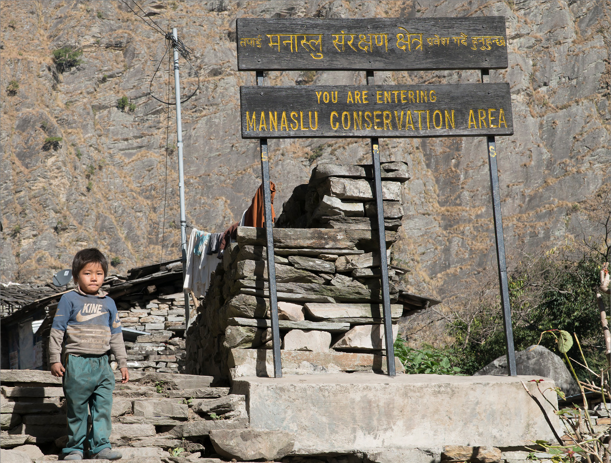
Manaslu
Days 41-44
Khorlabesi (860m) - Larkya La (5135m) - Dharapani (1860m) /126(972) km, 4 days/
Manaslu began for us with a persistent smell of donkey urine. You walk and every 300 meters there is a large puddle where they all pee. Caravans seem to pass by not so often - and it becomes unclear where so much of this goodness comes from?!
In Jagat, on top of that, there was a checkpoint where we were caught in deception - our permit had already expired. I looked - indeed, the permit for the national park expires today. We began to shout, swear, and wave our hands in protest. Then we calmed down, called our agent, and he said he would take care of everything and asked us not to worry. Nevertheless, we spent about four hours there waiting for our agent in Kathmandu to go and renew the permit and send them a scan of the new one.
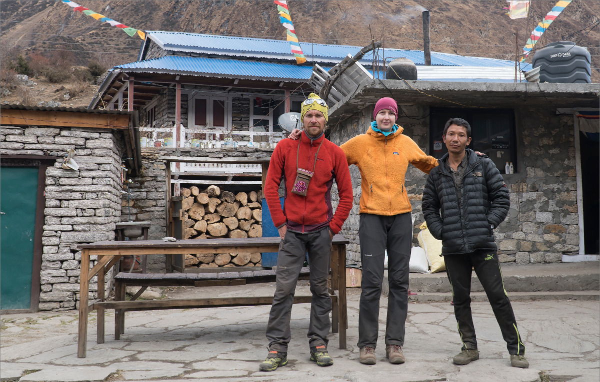
Then, after dealing with the permit, they began to pressure us about the lack of a guide. We didn't have a guide, nor did we want one. Besides, the financial aspect was also a concern. We tried to sort things out first in Jagat, then continued in Philim. As a result, they forced a "drunk guide" on us for 120 bucks for a couple of days. Expensive and useless. The guide was simply "irreplaceable". He hardly knew any English and was poorly oriented in the names of the mountains. He called most of the mountains "unnamed". Fortunately, we only had to tolerate him for a day and a half. Nevertheless, he did his job - in Samagaon, at a police checkpoint, they stopped us and refused to let us through, despite having the permits. They said that we needed a guide from Kathmandu. They were quite the circus performers. Our guide said the right things to them, and eventually they let us through. It's very difficult to communicate with locals in the Manaslu, Ganesh Himal, and Langtang areas. Their English is very poor.
In Samagaon, we waved goodbye to our guide and the $120 that went into his pocket, and headed to Samdo. Samdo is at 3800 meters, it's cold, and only one lodge is open. There are some Japanese people with guides sitting there. The guides decided to show off their erudition and said that Dharmasala (lodges at 4400 meters) are open. However, the locals claimed the opposite.
We started our morning in Samdo at 3 am. We left at 4, thinking we would reach Dharmasala by 6, have some tea and cookies, and then continue to the Larkya La pass. Dharmasala was open, and we arrived at 6, but there was no one inside. We had brilliantly sent all our lighters and matches to Kathmandu together with our gear and kitchen. Searching for something similar in the hut led to nothing, so we licked some sugar and continued on. The wind was blowing, and it became more persistent the higher we went. It was really cold. I was worried about Ani's hands and feet, although my hands were not particularly warm either.
The pass was enormous. It took us about 15 minutes to cross it. I kept thinking, "Okay, now we'll go down, the wind will die down, and we'll warm up." But it wasn't to be. The wind didn't let up until we reached the tree line. We had to stop once and warm Ani's hands under my armpits. That was the end of our adventure in the Manaslu region. We made it out and descended to Dharapani late in the evening.
Anapurna
Days 45-47
Dharapani (1860m) - Thorung La (5415m) - Mukhtinath (3760m) /36(1008) km, 3 days, 1 rest day/
Dharapani is located on the road, and there is a checkpoint right there. We got registered. Further towards Manang - there is a road and transportation. Ania and I didn't even hesitate much - we paid the money and went to Manang. Especially since we were slightly late for the drop-off, or rather, for the guy who was supposed to bring us there. It would have been okay, but then we stopped at a roadside cafe where the driver took us to have breakfast. Well, that was it... Goodbye, stomach. In short, I barely made it to Manang. At first, I couldn't understand what was happening, why I was feeling worse and worse, and started to shiver. Then it dawned on me that I was poisoned.
Long story short, we slowly made our way to Yak Kharka, occasionally visiting the nearby bushes, as we definitely couldn't reach Thorong Phedi with such a speed today.
In Yak Kharka, I was a regular visiter of the "00" office. I only ate rice without anything. I also took pills that Ania fed me. But in the morning, I felt a bit better and at 5 a.m. we headed towards Thorong Phedi and then towards the pass. Despite feeling tired, we managed to overtake some local monk-tourists on horses. They shouted to us, "See you at the pass." We also met an Indian tourist who walked 20 steps and then rested... Poor guy.
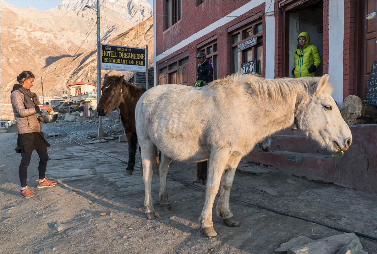
Mukhtinath greeted us with sunshine and the Ukrainian-Russian Lodge "Dream Home". Now the food became even tastier. In addition, we received a gift from our Riga friends Vova and Nastya in the form of a package with various instant food. How could we not stay for a day of rest?!
We were only worried about the absence of our person from Kathmandu with the drop-off. Eventually, we found out that he was coming and would arrive tomorrow. The whole "tomorrow" day passed in waiting, but by evening he finally appeared. We had already planned and calculated everything without him for Upper Dolpo, but then we looked at the permit - it was for Lower Dolpo. At first, we started calling and cursing, but then we thought, it's cold and hard there.. Forget about Upper Dolpo - we'll come back next time and explore it separately. In the summer!!! Anyway, we calmed down and decided to settle for Lower Dolpo.
Lower Dolpo
The day had come, it was time to move on. After eating the last serving of apple pie, we got into the jeep and quickly rolled down to Kagbeni. There, we loaded up and the adventure began.
Days 48-50
Kagbeni (2810m) - Santha (3777m) - Niwas La (5120m) - Chharka Bot (4302m) /73(1081) km, 3 days/
From Kagbeni, we entered some kind of desert. Maybe it's green during the season, but it didn't look very appealing in winter. In Mukhtinath, we were told that people would be waiting for us with open arms in Santha, Chharka Bot, Dho Tarap, and Ringmo. So we walked all day and by nightfall, we stumbled down into Santha, but there was no one there. We looked around and shouted, but no one showed up. And we only had one spare day's worth of food left. We had no choice but to set up our tent and use up our supplies. We remember Chharka Bot (4302) and plan to arrive there the day after tomorrow.
In the morning, just at dawn, braving the bitter cold, we set off. While walking, an idea came to mind - why climb Jungben La (5550 m) when we can bypass it? People seemed to have walked this way before, there was a trail on the map. We decided to take the detour and that's when everything started. Loose scree, eroded and collapsed trails, some vertical conglomerates, icy rivers, and all of it for the whole day. By the end of the day, Anya was barely standing, and the descent from the pass seemed out of the question. But it was only 5200, not 8,000, so we pitched a tent, gnawed on the snow, and endured the cold and wind. And in the morning, we walked on. There was a lot of snow and icy rivers again, which slowed us down, so we spent the whole day only descending to Chharka Bot.
We walked along the river near Chharka and saw some tents and locals. We were wondering what they were doing there. When we got to Chharka, it was again eerily quiet. But this was no joke anymore... We had no more food. We walked and walked, and suddenly I heard music. I barged into a house and said "Namaste" and introduced ourselves as guests. It turned out that some guy had returned from the mountains, got cold there, and decided to grab some warm blankets from the house. And he was watching TV. So lucky for us, because there was nobody else in the village. The guy was a bit clueless though – he didn't know how to cook, and didn't really know where to find food. As a result, we bought some noodles from him, had them for dinner, and had some unsweetened tea because he couldn't find any sugar. But it was still better than being completely alone.
Days 51-52
Chharka Bot (4302m) - Chap Chu (4340m) - Chan La (5378m) - Dho Tarap (3944m) /39(1121) km, 2 days/
Onward we go. Winter makes itself felt. It's really freezing in the morning. Chharka Bot is at an altitude of 4300. We left at 7. By 9 am we descended to the river. And here's another surprise. There is no bridge. We read what Robin says - damn, and he's really not here, and Robin suggests crossing the river four times on foot. Well, the river is not deep, just above the knees. The width is 7-10 meters. But the altitude is 4,000, it's morning, there's no sun and it's freezing, well... I would say it's tough. There's nowhere to go, cursing everything and everyone, we get into the water. It's good that we have shoes. Otherwise, it would have been really sad to go barefoot. We crossed once, then about 300 meters later we crossed again... And apparently, we need to cross again ahead to bypass the pinch and then return to the right bank. But here's a miracle. There's a trail, well beaten, steeply climbing up into the rocks and ending at a nearly vertical inside corner formed by the edge of the gorge and a rock forming a pinch. Well, there are footprints, we need to explore. Ania is really swearing urging us to take a water bath again, but I'm relentless. We climb up, or rather walk at first, and then really climb. Because in the corner, steps are made of stones. The steepness is such that you need to use your hands too. At some point, when it seems like a dead end, I suddenly find myself in a grotto and help Ania climb out. A grotto. We check what's inside, and voila - a through cave. On the other side, there's a steep descent, and we bypassed two fords altogether. I really suspect that if we had listened carefully to the guy we stayed with, we would have bypassed the first two as well.
Chap Chu is a lake. It's frozen, but there's a stream. Then there's the Chan La pass and a long descent to Dho Tarap. In Dho Tarap, there are livelier people. We stayed with a woman of indeterminate age. In the evening, some of the women from the village came to see us. It's hard to say what they were chattering about!
Days 53-54
Dho Tarap (3944m) - Numala La (5309m) - Danigar (4500m) - Bagala La (5169m) - Polam (3250m) /46(1167) km, 2 days/
The old woman scared us with stories of knee-deep snow and how cold it is there. "Chini, chini!" What does "chini" mean? It means cold! Well, we are tough, so we continued on. Although she had planted doubts in me. But when we started walking, it became clear that it was nothing, there wasn't much snow and people had been walking there. There were footprints. The only problem was that our feet were getting wet in the snow with our holey boots. The Numala La Pass was particularly easy. Danigar is like a pole of cold or something. And the wind blows constantly. They say it's really nice here in the summer!
In the morning, for about two hours, we couldn't warm up until the sun came out. While we were walking uphill, we had to take breaks every 15 minutes. But the sun always brings warmth and that is a delight.
Bagala La was also passed quickly since we had already camped at 4500m.
We were almost running down because we were in a hurry to get to Ringmo. There were hotels and food there. But when we arrived at Ringmo, we realized that there were no people there. We were very disappointed, but suddenly a bespectacled Belgian guy appeared from below. He told us that there were people down there and we would soon reach them. But the impression of Ringmo was still spoiled - we didn't even go to the lake - we took a few pictures only because Anya reminded us to.
The Belgian is also a GHT crosser. But he's going in the opposite direction. At the beginning of autumn, he tried to go in our direction but froze on the Sherpani Col. He recovered and is trying again. After chatting for about 10 minutes, we hurried down as it was soon getting dark and there was no food again.
Days 55-56
Polam (3250m) - Kagmara La (5115m) - Huricot (2700m) /53(1220) km, 2 days/
In Polam, we spent the night in a local hut as we like to do. We gave some gifts to the woman and her daughter, such as windproof pants, a compass, and some other small items, which ended up on the shelves of the hostess.
We have to cross another five-thousand-meter pass and descend to Jumla for the next section, which is an exit from Lower Dolpo. On the way to the pass, we stopped at a village to eat and also decided to gift the locals some sleeping bags and mats as an advance payment. This means we went on with our night stays, and they came to us in the morning and took the sleeping bags and mats. Now our backpacks are virtually weightless!
The pass was pleasant and the road to Huricot also mostly pleased us. Once we met a Tibetan shepherd who brought a boy with a broken arm out of a village and gestured to us to help him. We yelled at him, told him to take the boy to a doctor, and gave him painkillers. But then we realized that the boy probably wouldn't see a doctor, as there was a military post below, and the Tibetan himself was possibly an illegal immigrant.
We were treated to a delicious dinner at the post. The soldiers pleasantly surprised us. They fed us, gave us drinks, gave us advice, and even gave us the address of a person we could stay with in Huricot. This was helpful for us since we arrived in the village in the dark, and it can be difficult to find anything there at night.
Jumla and Mugu
Days 57-59
Huricot (2700m) - Jumla (2380m) /25(1245) km, 3 days, 1 rest day/
This region made us fight.. Fight with the dust and the local population. At first, we were walking fine on the trail.. It was dusty, but no mules were visible and it was okay. At some point, we hit a road that was under construction. And then the dust started. Along the road, everything was overturned.. No aesthetics. Then, reaching Chauricot, we learned that we could ride on a tractor here. But the tractor had already left.. Not too long ago. We thought it would be better to ride badly than walk well and set off in pursuit of the tractor. We probably walked for three hours and finally caught up with it before the pass. People were sitting there having lunch. We loaded up on the tractor and went on.
Driving in a tractor is pure torture. It shakes and bounces you around, and there's almost nothing soft around you. And there's also this dust. It's everywhere. I looked sadly at my camera, which had already accumulated a full lens of dust and creaked when I tried to use the zoom ring.
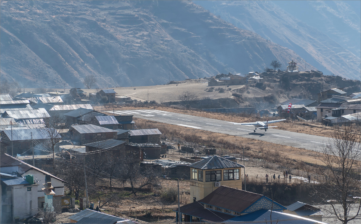
The next day, we only reached Jumla by evening. There is an airport here, and you can even fly to Kathmandu, but we're not like that. We're going further!
Days 60-64
Jumla (2380m) - Simikot (2910m) /150(1395) km, 5 days/
Further, the hell of dusty roads let us go, and we were back on the trails. Almost a whole day on the good old trails. But by evening, we were back on the road, although this time without dust. What to do – Nepalese people are too lazy to walk – so cars are everywhere in the country.
As soon as we passed Gamgadhi, the donkeys and dust immediately started. The donkeys go uphill faster than us, so there's no way to get away from them. And the drivers, jerks, seeing us running away from them - they chase them even harder! Fortunately, they don't move fast downhill, so we can get away.
The food situation became really sad. The only things that could be bought in the store were Chinese instant noodles and cookies, as well as rice with lentils. Tea was rare, and they mostly drank weak instant coffee, which they called tea.
The local population has also changed for the worse. Children don't give way, older ones stare and stand in the way... When we pass by, they start shouting something indecent after us.
The experience of communication is mainly negative. Either they try to cheat, or they overprice things, even though the price was agreed upon initially, or they don't give the correct change. In this region, I started to count my change for the first time, and 4 out of 5 times - some amount was missing.
On New Year's Eve, the situation became even more complicated. I got sick and could barely walk. I took a magic anti-inflammatory pill and felt better by evening. We were staying in some kind of shack at 3,000 meters, and the owner was inhospitable and stingy with alcohol.
We warned him about our early wake-up, but he overslept. Even our kicks on his door didn't help. So we made breakfast ourselves, left some money on the stool, and left.
After about 3 hours, he catches up with us. He doesn't speak English at all, all we hear is the word "police" and he waves his phone. In short, he's a jerk. Naturally, he didn't believe that we left him money, so we had to give him more. We didn't want to deal with the local police.
Simikot is already looming on the horizon, but the locals continue to cause trouble for us. One guy pretended to feed us lunch, after which he tried to squeeze out extra money and didn't want to give change. We dealt with him for probably 30 minutes. We walked around the village where he demonstratively looked for someone to make change and of course no one did. Well, in the end he understood that either we would leave now or he would find change.
We tried to find a trail bypassing Simikot through the lowlands to reach Dharapori directly. But they are building a road there, so everything is dug up again. The locals claim that there is no road down below, only through the top. And then yesterday's illness attacked me. I had a never-ending cough. Anya was worried, felt my forehead, and there was a fever. We decided to go to Simikot for now and figure it out from there. In Simikot, we found out that there is only one decent lodge, owned by a local Buddhist lama. The rest of the folks there are all Hindus.
The lama's place is clean, tidy, and the food is much better. He helped with transferring money, arranged for us to stay in a free room, and only took money for food. And in the end, he helped us arrange our tickets and make sure we got on the plane.
The Far West (unrealized)
After Simikot, we needed to conquer a couple more passes and, having covered 80 km, finish in Hilsa. Lack of time and my not-so-great health condition prevented us from doing that. Although, of course, we were eager to... How could we not be?
Conclusion or Epilogue
Let's summarize and calculate the calories spent.
Over the course of 63 days, we covered 1500 km on our own and a little bit with transportation. We walked a total of 1386 km. We had 59 walking days and 4 rest days. We walked for a total of 476 hours. We gained 84 km in elevation and lost 81 km. We crossed 30 mountain passes, half of which were over 5,000 meters, and two of which were over 6,000 meters.
We spent 2500 USD on food and accommodation.
In other words, we completed the GHT High Route with a small deviation - a jeep ride from Dharapani to Manang and Lower Dolpo instead of Upper Dolpo. Overall, given our autumn-winter conditions, this is a good option, as this route is usually walked in the spring when the days are longer and people approach Dolpo closer to summer, when it's warmer and there are more people around.
Our pride is that we crossed all the technical passes and did not bypass anything, despite the cold and "bad conditions" that we often heard from locals. Of course, we are not terminators, and we still used a porter twice - once at the Nanga La pass (considering it a drop-off), and the second time sending our stuff from Chukung to Namche Bazaar. Overall, this also counts as a drop-off. In addition to this, we used the services of a guide twice, once in Langtang to avoid getting lost in the forest while bypassing the "strange hill at 3900", and once when a guide was forced upon us in Manaslu where he was not really necessary. Otherwise, we walked on our own, thankfully the trail was there!
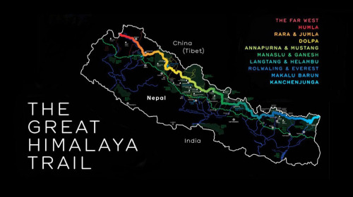
Passes
- Nango La (4776 m)
- Lumbha Sambha Pass (5159 m)
- Molun Pokhari Pass (4200 m)
- Kalo Pokhari Pass (4300 m)
- Sherpani Col (6180 m)
- West Col (6190 m)
- Amphu Lapcha Pass (5845 m)
- Cho La (5420 m)
- Renjo Pass (5360 m)
- Tashi Labsta Pass (5755 m)
- Tinsang La (3778 m)
- Tilman Pass (5308 m)
- Khurpudada Pass (3710 m)
- Pansan La (3830 m)
- Mangro Bhanjyang (2936 m)
- Myangal Bhanjyang (2975 m)
- Larkya La (5135 m)
- Thorung La (5415 m)
- Pass (3810 m)
- Bhima Lojun La (4460 m)
- Niwas La (5120 m)
- Chan La (5378 m)
- Numala La (5309 m)
- Bagala La (5169 m)
- Kagmara La(5115 m)
- Maure Lagna (3894 m)
- Daphe Lagna (3685 m)
- Ghurchi Lagna (3445 m)
- Changkheli Lagna (3594 m)
- Margor Lek Bhanjyang (4037 m)